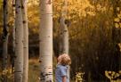
The Medicine Bow National Forest provides year-round recreation opportunities. Activities including hiking, biking, camping, horseback riding, ORV riding, fishing, and hunting are at your disposal in the spring, summer, and fall months. In the winter there is snowshoeing, snowmobiling, skiing, and snowboarding. Beautiful vistas await sightseers and photographers. The topography varies greatly within the national forests with the elevation ranging from 5,500 to 12,013 feet. The months of July and August bring a gorgeous array of wildflowers, and wildlife sightings are not uncommon and may include critters such as pica, marmots, foxes, moose, and, less frequently but still prevalent, black bears and mountain lions.
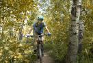
Happy Jack Recreation Area, Vedauwoo Recreation Area, and the Snowy Range Mountains are major points of interest. Laramie is surrounded by the forest boundaries with Vedauwoo and Happy Jack less than a 15-minute drive east of town and the Snowy Range approximately 35 miles west. Access to campgrounds, picnic sites, observation points, and hiking trails are plentiful, and high alpine lake recreation such as trout fishing and paddleboarding or kayaking are popular attractions. Any section of the forest is excellent for those looking to try out new activities on relatively easy hiking terrain that is well-signed and supported by pronounced landmark navigation. More experienced outdoor enthusiasts and those looking for more of a challenge won’t be disappointed, either.
Accessing the peak area of the Snowies is relatively easy because of the Snowy Range Scenic Byway that cuts through the forest. If you are traveling on I-80 through southeastern Wyoming, you can reach this scenic drive by exiting from the west at Walcott Junction, 20 miles east of Rawlins (follow signs for Saratoga). Or, if accessing the byway from Laramie, you’ll take Exit 311 for Snowy Range Road. The byway does have a short season with the highest part of the highway sitting at just under 11,000 feet above sea level. The route is cleared of the snowpack at the end of May and closes back up by mid-November.
For maps and guides stop into the Laramie Visitor Center or the Laramie Ranger District. Visit recreation.gov to make reservations or find out more details about the facilities.