


Backpacking In The Snowy Range Mountains
by Dani and Brian Harrington, photos courtesy of Brian Harrington
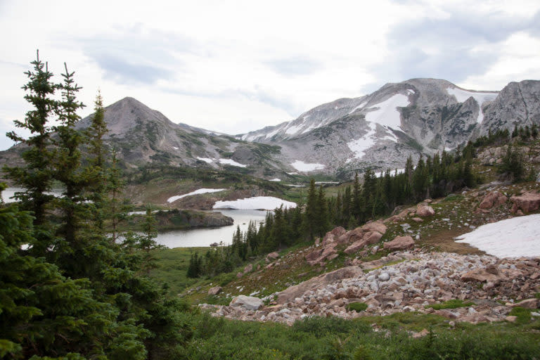
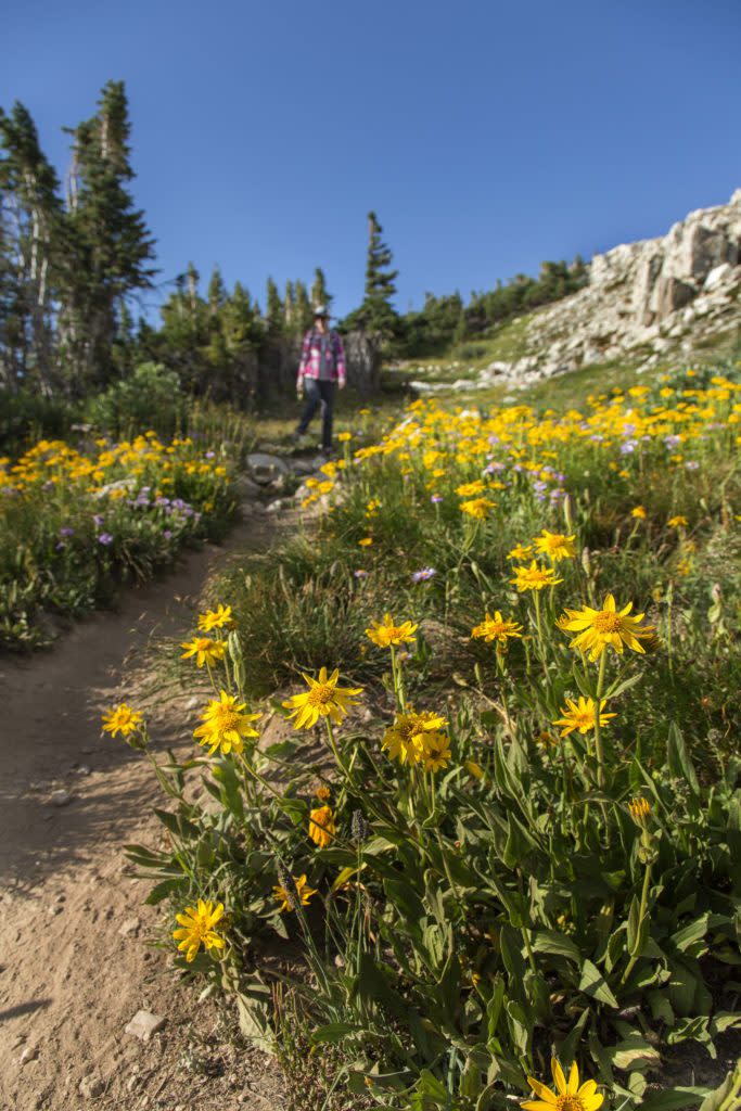
The Snowy Range Mountains are a true gem of southeastern Wyoming. Shaped by a rich glacial history, the high alpine scenery of this range is stunning and boasts over 100 pristine lakes amidst a backdrop of looming granite peaks. The months of July and (early) August bring a gorgeous array of wildflowers, and wildlife sightings are not uncommon and may include critters such as pica, marmots, foxes, moose, and, less frequently, black bears.
The “Snowies” lie just 35 miles west of Laramie in the Medicine Bow National Forest. Access to campgrounds, picnic sites, observation points, and hiking trails are plentiful with high alpine lake recreation such as trout fishing, paddleboarding, and kayaking as popular attractions.
With all there is to do and see in the Snowy Range, backpacking is a great way to experience these Wyoming mountains. The Snowies are excellent for those looking to try out backpacking for the first time on relatively easy hiking terrain that is well-signed and supported by pronounced landmark navigation. More experienced hikers and those looking for more of a challenge won’t be disappointed, either.
Below, we describe several backpacking routes in the Snowy Range Mountains to help you pick your trail, depending on what kind of adventure you are looking for. No matter where you go, your experience is sure to be scenic and memorable.
But First, A Few General Tips
Backpacking is an incredible way to get outside and experience nature. However, it is an activity that requires some preparation, safety considerations, and respect for nature. In general, it’s a great idea to recruit at least one other person to accompany you rather than go it alone. It is also important to choose a route that suits your experience level rather than push yourself beyond your limits. Do a quick google search to help you double-check your list of packing essentials and safety equipment, and be sure to bring plenty of food and water. Additionally, don’t forget to inform yourself about any restrictions (such as fire bans) and any permits that may be required. As of this writing, the Snowy Range Mountains do not require permits for backpacking. Finally, please leave the mountains as clean (or cleaner) than you left them.
And now, let’s hit the trails.
Browns Peak Loop Trail
The Browns Peak Loop departs from the Lewis Lake Trailhead, accessed via the Sugarloaf Recreation Area, and circles the beautiful Browns Peak. This 12.5 mile loop is great for those hoping to snag a trout or two along the way given that it meanders right along Lewis Lake, South Gap Lake, North Gap Lake, and Cutthroat Lake. Though all hikes in the Snowies are scenic, I would classify this area as especially so due to all the water and views of the peaks.
The Browns Peak Loop is the busiest of the three trails we review here, but is also fairly easy, well signed, and, as noted above, incredibly beautiful.
Deep Creek / Rock Creek Trail
Deep Creek / Rock Creek Trail is a 14.9 mile out-and-back trail that departs near Arlington (off I-80). Less traveled than Browns Peak Loop, it is still consistently used and follows Rock Creek, which provides a wonderful opportunity for fishing. Backpackers will experience over 2,000 feet in elevation change on this trail, which is rated as “moderate” on the difficulty scale, likely because parts of it contain loose rock and can be quite narrow. The trail is nestled among a lovely forest setting and features a few small bridges and a little waterfall.
You may choose to hike from the Rock Creek Trailhead to the end of the trail at Sand Lake and, rather than turning around for the out-and-back route, continue on to the Sheep Lake Trail until you reach Sheep Lake. From there, take the Gap Lakes Trail to reach your final destination at the Sugarloaf Trailhead at Lewis Lake. This route totals around 14 miles, making it similar in distance to the out-and-back option, but it does require a shuttle.
Sheep Mountain Trail
For those looking to encounter fewer people on their hike, the Sheep Mountain Trail is the least-traveled recommendation on our list and is rather challenging, though incredibly scenic and rewarding. The trail starts at the Forbes Game and Fish Trailhead on Fox Creek Road and climbs 2,000 feet in elevation, with 1,300 of those vertical feet occurring in the first 3.5 miles of the hike. The Sheep Mountain Trail is 12.6 miles in total and cuts right down the center of the range. While you can certainly choose to make this a point-to-point hike, many visitors end up using the route as an out-and-back, turning around when they’ve reached their comfort level for exploration and fitness. The top of the trail traverses a wide basin that supports snowmelt streams, wetlands, and a wide variety of wildflowers, despite looking rugged and bare from below.
Ready to hit the trail? Explore the rest of our website to learn more about hiking, camping in the Snowy Range, and more to make the most of your trip to the Snowy Range, just west of Laramie, Wyoming.


